
Lake Ontario used to be home to a thriving population of Atlantic Salmon (Salmo salar). The Lake Ontario Salmon Habitat Restoration Program works to bring this species, part of Ontario’s rich biodiversity, back to the lake. The Program has four components: fish production and stocking, water quality and habitat enhancement, outreach and evaluation, and research and monitoring.
One effort to support restoring Atlantic Salmon to Lake Ontario was a bank stabilization project in Cobourg. The site, partially on municipal land and partially on private property, is on Cobourg Brook. The private landowner has supported the Lake Ontario Atlantic Salmon Restoration Program since 2006 by allowing the program to assess out-migrating Atlantic Salmon smolts and enhance fish habitat on the property. The land was used as a pasture at one time and a significant amount of vegetation had been cleared right up to the stream edge. A 40m section of stream bank running parallel to Highway 401 had severely eroded due to lack of woody vegetation combined with a composition of fine soil and a steep bank face (Figure 1). This caused excess sediment to enter the creek, which is known to impede aquatic life.
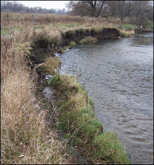
Figure 1. Severely eroded stream bank prior to restoration efforts.
Figure 1. Severely eroded stream bank prior to restoration efforts.
Program volunteers determined that re-grading the slope to 2:1, strengthening the bank with angular stone and planting trees and shrubs would be the best course of action for the creek and its inhabitants. Five Little Underwater Neighbourhood Keepers Encompassing Rheotactic Salmonids (L.U.N.K.E.R.S.) were incorporated into the design to provide instream cover for Atlantic Salmon by mimicking overhanging banks (Figure 2). The direct benefits of the bank stabilization project are reduced sediment entering the creek, improved riparian habitat and additional instream cover for fish. In recent years, sampling the fish community at this site has shown that Atlantic Salmon smolts and other juvenile and adult salmonids are utilizing the enhanced streambank habitat.
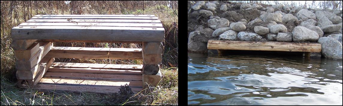
Figure 2. L.U.N.K.E.R.S. placed instream to create habitat for Atlantic Salmon and other coldwater fish species in Cobourg Brook (left); L.U.N.K.E.R.S. with boulders on top to hold it in place (right).
Figure 2. L.U.N.K.E.R.S. placed instream to create habitat for Atlantic Salmon and other coldwater fish species in Cobourg Brook (left); L.U.N.K.E.R.S. with boulders on top to hold it in place (right).
Since completing the bank stabilization portion of this project in 2008, Program partners have planted 2,970 native trees at the site along with over 684 shrubs to re-vegetate the stream bank and adjacent field. More than 190 volunteers supported the effort through planting trees and shrubs, empowering local communities with awareness and a sense of ownership of the health of their watersheds. These plantings contribute to the health of Lake Ontario.
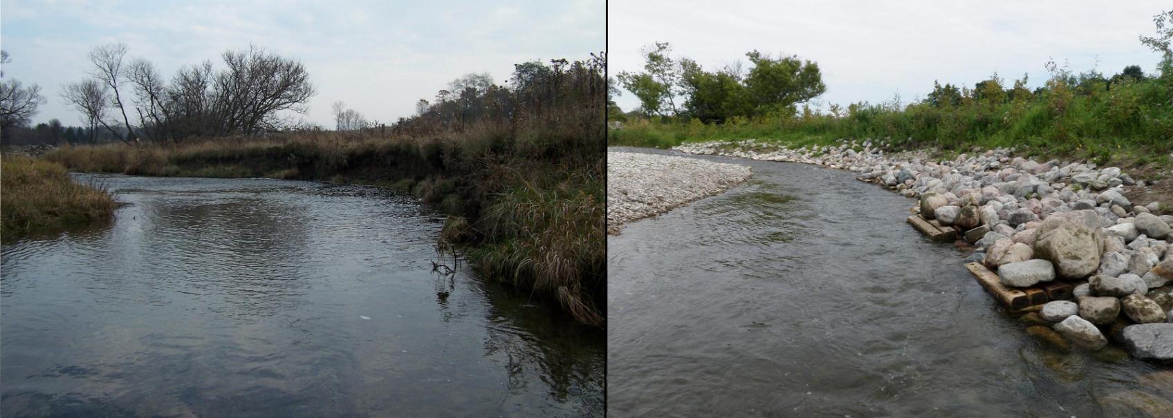
Figure 4. Bank stabilization project before (left) and after 1 year (right). Note the stream channel has narrowed and the water is much deeper than before the project was undertaken. The point bar (gravel) on the left of the after photo was deposited naturally after the first big rainfall in the spring.
Figure 4. Bank stabilization project before (left) and after 1 year (right). Note the stream channel has narrowed and the water is much deeper than before the project was undertaken. The point bar (gravel) on the left of the after photo was deposited naturally after the first big rainfall in the spring.